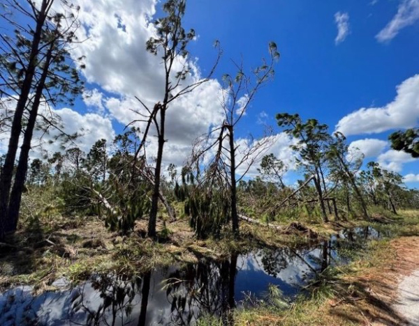
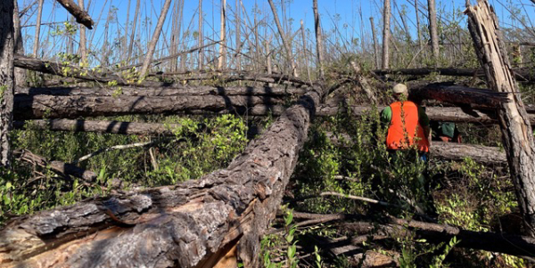
Hurricanes can have devastating impacts on our forests at both the local and landscape scale. The intense wind and precipitation brought on by these storms snaps trees like toothpicks, impacting habitat, increasing fuels for wildfires, and leaving trees susceptible to disease.

As climate change increases the intensity and frequency of hurricanes and other wind events, the Forest Service collaborated with the Southern Group of State Foresters and National Aeronautics and Space Administration (NASA) to develop a model which would provide a rapid assessment of timber damage.
“Timber is a critical part of the economy in our Southern states, so measuring damage to forested land is vital for the economy as well as the environment,” said Renee Jacokes-Mancini, a remote sensing coordinator for the Forest Service. “After a major hurricane, you aren’t sure where damage has occurred, and aerial or ground observations take time.”

This lack of information based on directly observed data can create a period of uncertainty, which limits the ability of decision makers to allocate resources. A new model, called Tree Structure Damage Impact Predictive, or TreeS-DIP, fills that gap.
Now that we are in peak hurricane season, the Forest Service hopes this tool will provide resource managers an initial picture of where and how intense potential damage is, with the goal of allocating resources as rapidly as possible to keep communities safe.
Last September, the TreeS-DIP model was put to the test for the first time after Hurricane Ian made landfall along the coast of southwest Florida. Ian came ashore as a strong category 4 hurricane with windspeeds estimated at 150 miles per hour. Ian’s path damaged approximately 165,000 acres of timber. National Oceanic and Atmospheric Administration (NOAA) ranked it as one of the costliest hurricanes in U.S. history in terms of property damage.
Before Hurricane Ian made impact, state agencies in Florida reached out to the Forest Service to use the model. Pulling data from multiple agencies, including NOAA, NASA, Forest Service, and Southern Group of State Foresters, the Forest Service was able to provide a map to show Ian’s impact and the location of tree damage at the landscape level.
“Within 48 hours after the event, the Forest Service provided spatial datasets to us depicting forest damage areas in four categories: catastrophic, severe, moderate, and light. These model results were a real ‘game-changer’ in our ability to assess timber damage much faster than in the past,” said Jarek Nowak, Ph.D., utilization and hydrology supervisor for the Florida Forest Service.
The data that was generated provided timber damage analyses at a time when flight restrictions were still in place and roads were impassable due to flooding in the Hurricane Ian impacted areas.
“After a storm event, leaders want to know where to allocate resources and up until now we have not had a rapid response product,” said Nowak. “This tool allowed us to make data driven resource decisions to optimize the allocation of response resources during times of uncertainty.”
Florida’s emergency response teams were able to combine the data from the Forest Service with their existing information to determine affected forest types on both private and public lands and share that with state and federal agencies and partners.
“The end result provided us an estimate of timber damage valued at $32 million dollars, 3 million tons, and 165,000 acres caused by Hurricane Ian in the 11 affected Florida counties. All this was accomplished within days after the hurricane struck,” said Nowak.
TreeS-DIP is currently used operationally by the Forest Service as a rapid response tool to provide initial damage assessments as needed. It is based on a predictive model and not designed to replace more intensive ground or aerial observations. The data generated should only be used to prioritize and direct limited response resources before ground observations can occur.

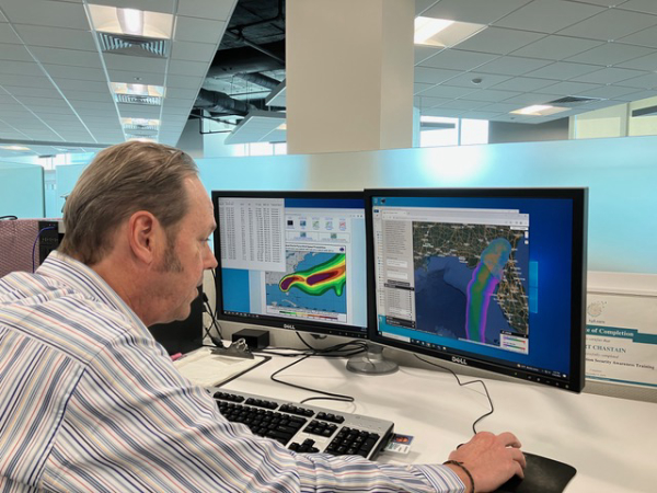
The predictive model is based on wind, tree tolerance and other environmental contributors. To learn more about the TreeS-DIP workflow led by Robert Chastain, Ph.D., a Forest Service contractor for RedCastle Resources at The Geospatial Technology and Applications Center visit https://fs.usda.gov/about-agency/gtac.
— Sheila Holyfield, Southern Region Office of Communication